The Science History Institute Museum is closed for renovations.
The Othmer Library remains open by appointment.

Distillations magazine

Unexpected Stories from Science’s Past
December 5, 2024 Environment

Proxies for Justice

The climate history of tropical regions has been chronically understudied. Correcting the record will require new methods and new mindsets.

Black and white photo of a man standing beside a cross-section of an enormous tree
About SUPPORT OUR WORK

Sewer smell calls to mind parts of a city we would rather ignore. It’s incongruous with something as picturesque as the Salto del Tequendama. Yet the scent is unmistakable as the cascades spill from the lush Andean forest. This 132-meter-tall waterfall is emblematic of the high plain of Bogotá. Indigenous Muisca people believe their god Bochica broke open the falls to drain the plateau after a great flood imperiled their ancestors. These days Tequendama’s waters course toward a treatment plant, built to filter the reeking pollution that travels 20 miles downstream from Bogotá.

The treatment plant sits near a rocky outcrop that has stood for millions of years, long before any human set eyes on the falls or the falls existed at all. The rocks have seen the high plain of Bogotá morph from sweet-smelling forest to stinking swamp. They have sat at the bottom of an enormous lake so deep it could submerge most of Bogotá’s buildings.

We know this because these rocks are not just witnesses to the region’s environmental changes—they record them. Climate scientists call them archives, enduring natural features whose physical and chemical characteristics are steadily shaped by their surroundings. Other common climate archives include corals, ice cores, lake sediments, and tree rings. Geochemical, physical, geological, and biological measurements obtained from these archives are called proxies. Scientists can read proxies like detectives read a crime scene, collecting clues in the climate archives that help decipher changes in environments and plant communities from the intangible past.

The relative ubiquity of archives such as the outcropping at the Salto del Tequendama may lead one to believe access to the deep past is available to scientists around the world, but that’s not the case.
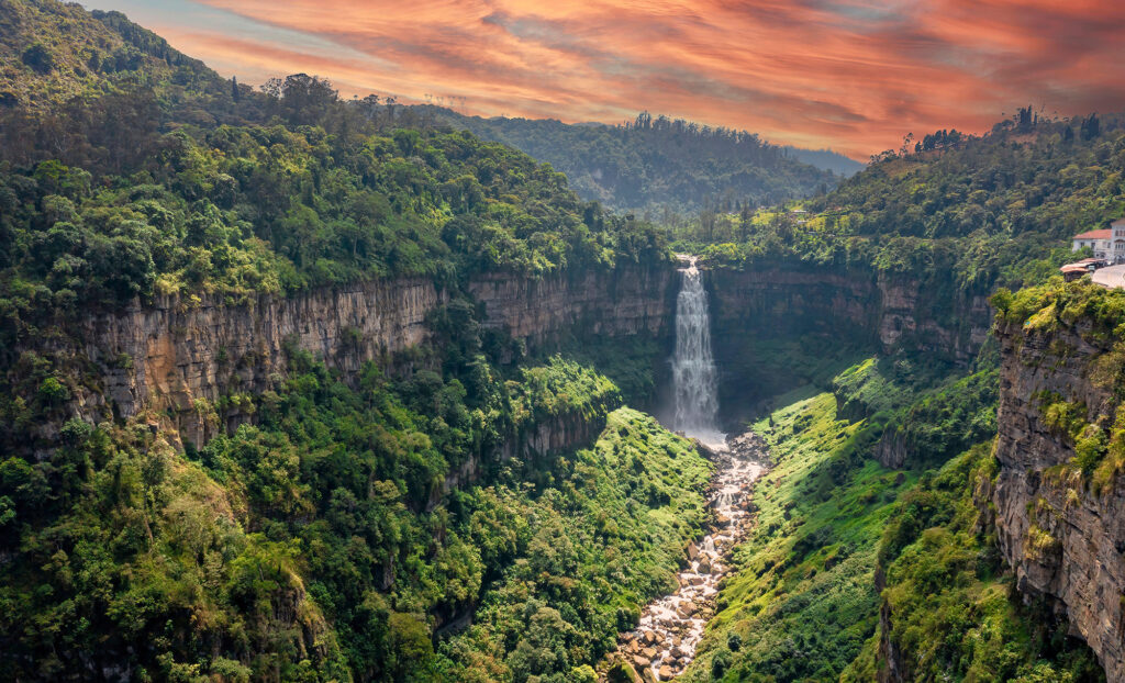
Aerial color photo of a steep waterfall in a rocky jungle environment
El Salto del Tequendama, February 2020.

Scientific papers and literature guide the journey to these bygone territories. However, most of this discourse comes from Europe, the United States, and other mid-to-high-latitude regions, not tropical ones like Colombia. Likewise, the universities that house the bulk of the samples from these archives are located in colder climates—places where it is hard to imagine the tropical forests that once stood or how they smelled. But this experience-based imagination matters. It helps us understand how ecosystems changed before the arrival of humans and helps us grasp how resilient they have been over millions of years.

Societal disparities have made some regions better known than others. The geological past of the Salto del Tequendama, for example, is lesser known outside of Colombia than other climate archives. Inequalities in climate science, such as language barriers and the uneven geography of knowledge production, hinder our understanding of climate in tropical regions and the southern hemisphere. For climatologists in the tropics, these inequalities exacerbate problems that hamstring all climate science—poor data standards across regions and disciplines, lack of access to reproducible open data, and even the lack of collaboration and data sharing across disciplines. And that’s only part of the story; some archives themselves embody climate injustices. Consider tree rings.

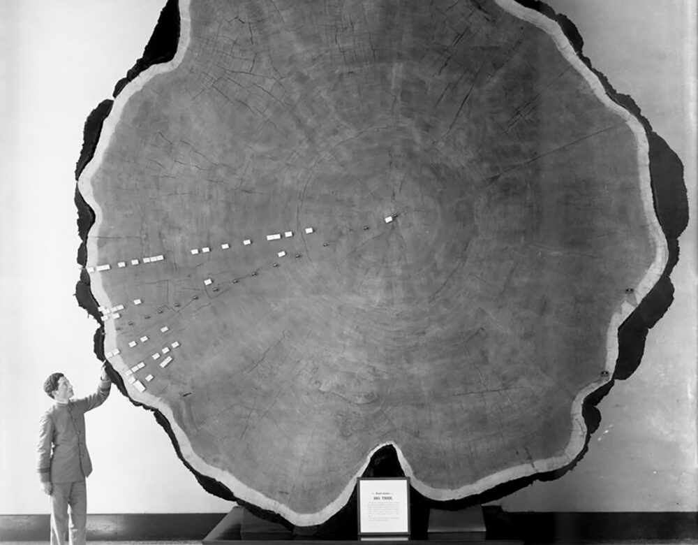
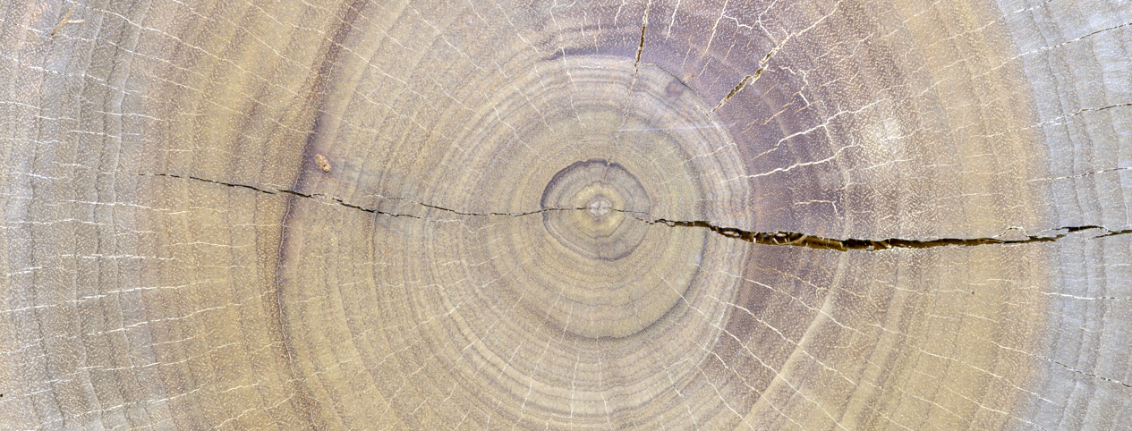
Cross section of a tree showing rings
Cross section of a Tachigali colombiana tree, from Colombia’s Chocó rainforest.

Dendrochronology, or the study of tree rings, developed gradually during the latter part of the 19th century, when knowledge of botany, climate, and geography unabashedly served imperial expansion. Today, dendrologists still analyze tree rings to investigate climate patterns over time. However, their studies of tree rings often do not tell everyone’s stories. They can’t.

Most tree rings are artifacts of wintering. They are a demarcation of a tree’s relationship with climate, topography, and geography that also tell us when a tree goes dormant. As a tree’s vascular cambium, its principal growth tissue, suspends activity during the winter, a scar is left in the tree trunk, which records a story of change over time. When compiled and analyzed, these scars offer us powerful archives and perspectives of how climate has changed and how trees have outlasted climate change. Tree growth rings can tell us about hydrological conditions such trees went through. By measuring the growth of different rings, scientists can also determine how water availability changed during the growing season and reconstruct a history of hydroclimate in the tree’s region. However, tree ring–based archives are not standard or evenly distributed across geographies. Where there is no winter, tree rings are harder to find.

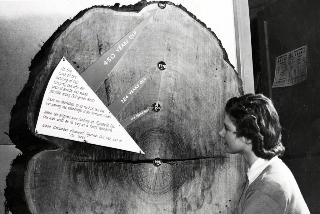
Black and white photo of woman looking at a large cross section of a tree marked with labels and dates ranging from 1940 to 1492
Examining tree rings at the University of Idaho, 1940.

Many people assume all trees grow with rings regardless of geography. But tropical tree rings are about as natural as snow in the desert. Tree ring archives are contingent on temperate conditions and should be highlighted as such. Doing otherwise divorces trees from climate and geographical context and so undermines climate literacy—the skill and science of learning what influences climate and what climate influences. Some rare cases of tree rings driven by temperature seasonality at high elevations have been reported, but this uniqueness does not represent “the tropics.” They do not fully speak for tropical regions.

Only during the past decade, as more scientists from the tropics started studying their trees, has dendrochronology begun to tell a true tropical story. More and more tropical tree rings have begun to appear. Wintering as we know it in middle and high latitudes is not the reason for these rings; rather, it is the fluctuations of rain that characterize seasons in tropical regions. Water deficit (seasonally dry) and excess (seasonally flooded) dictates the seasonal growth patterns of most tropical tree rings.

The existence of these rings has been known for decades, but they have been understudied as these tropical trees don’t follow the staple rules of dendrology that come from higher latitudes; their patterns are often seen as less consistent and unreliable. Recent investigations by tropical scientists are toppling this notion. In the Pacific coast of Colombia’s Chocó region, one of the rainiest forests on Earth, a mystery of factors produces rings in more than 60 species of trees—a puzzle local scientists and Afro-Colombian communities are studying now.

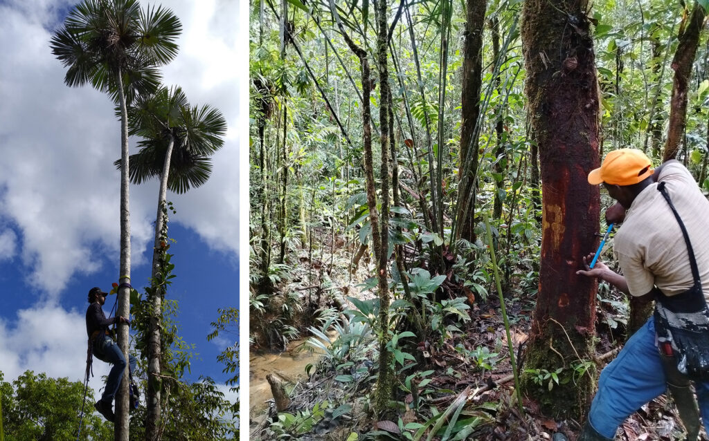
Grouped color photos, the left showing man climbing a palm; the right showing a man taking a core from a tree in a tropical forest
Left, Dendrologist Jorge Giraldo Jiménez installs a camera in a palm tree to take time-lapse photographs of the Chocó rainforest canopy around Bajo Calima, Colombia, December 2020. Right, Local resident Sixto Cáceres, an expert of the Chocó rainforest, extracts a core sample from a Tachigali colombiana tree, October 2024.

As climate change affects our ecosystems, natural archives become fundamental in deciphering the possibilities of how our land is going to change. Over the past decades, many scientists have used these archives to tell stories about past and future climate. Much of the attention has been focused on “truth-spots,” research sites that lend credence to climate science and wield outsized influence within the field, shaping research programs and scientific concepts. The Arctic is perhaps the most well-known truth-spot, and what even constitutes reliable information is based on studies on such high-latitude places.

Until now, the tropical truth-spots to receive the most attention are marine sediments and oceanic coral. Less attention to, and funding for, the other archives in tropical latitudes is a living legacy of colonialism and its persistent perversion of knowledge formation. It is not that these regions lack a diversity of proven archives; researchers, many of them from temperate climates, have established the value of stalagmites from tropical caves and ice cores from tropical glaciers. But this type of parachute science perpetuates a political and socioeconomic reality wherein scientific institutions in the highest latitudes prioritize knowledge tied to resource extraction, economic development, and military-industrial complexes. Deciphering the climate mysteries in tropical regions for public health, human rights, and biodiversity has never been a priority.

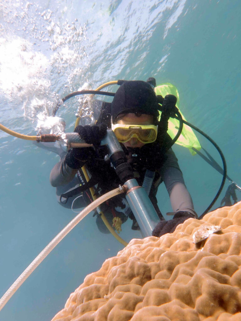
person in scuba gear in bright water drilling a hole in a large coral
Intan Nurhati drilling a coral sample in the Seribu Islands of Indonesia, 2016.

As a result, climate change projection models of tropical latitudes offer less reliable information and disagree more when compared with models of temperate latitudes. More accurate and useful models for tropical regions require new climate archives and new ways of thinking about archives.

Through her study of tropical marine archives, paleoclimatologist Intan Suci Nurhati is adding to conversations about historical climate change while improving our understanding of future climate impacts in the Indo-Pacific region. Nurhati does this by generating modern high-resolution records of climate variability alongside studies that reach back thousands to hundreds of thousands of years. Specifically, Nurhati analyzes “anthropogenic signatures” of climate and marine environmental change through corals, deep-sea sediments, and pollutants such as anthropogenic lead, microplastics, and pharmaceutical residues. In other words, she is incorporating anthropogenic pollution into climatology. Nurhati’s pollutant-based proxies are particularly salient because they chronicle climate change through records industrialization has left behind. Through the analysis of anthropogenic lead, for instance, Nurhati and others are providing new methods to track the rise of lead contamination in coral reefs, while also showing that lead is both impacting and is impacted by warming waters.

Other pollutants may offer similar insights. Given similar problems of naturally occurring and unnaturally occurring arsenic contamination across the Pacific, arsenic deposits could also serve as climate archives in tropical regions where various industries have disrupted arsenic cycles.

Marine archives give us an idea of how the surface of the ocean in tropical latitudes could change, but how are those changes going to impact humans and the ecosystems in which most people live? Insights from tropical marine archives can tell us only so much about what the climates of tropical lands looked like in the past and how they will change in the years to come. Growing terrestrial tropical archives and proxies, made by and for the tropics, is crucial to addressing the challenges of what humans will encounter ahead. This task is especially urgent for latitudes where 40% of the world’s population resides; where developing countries make up more than 95% of the land; and where people are already experiencing increasingly extreme weather conditions—hurricanes in the Caribbean, drought in parts of Africa and the Middle East, and flooding in Southeast Asia.

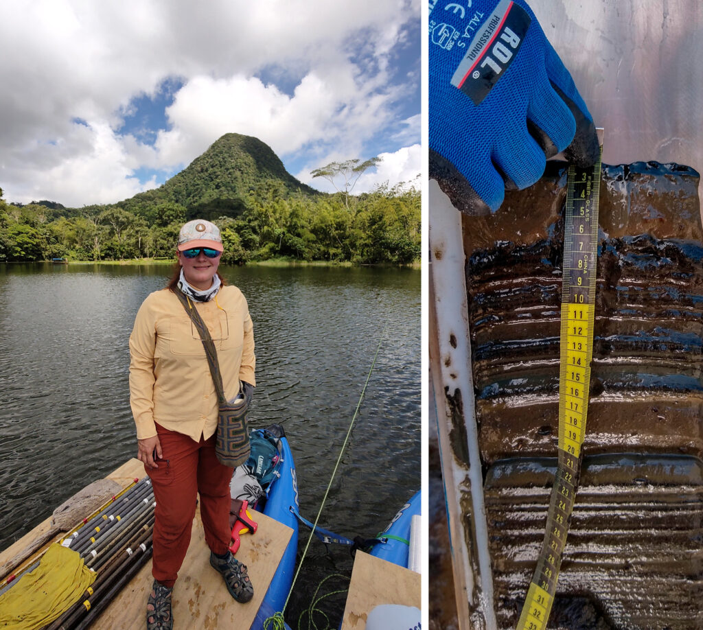
Two photos, left showing a researcher on boat on a lake in a lush, mountainous area; right image shows a close of a muddy layers of sediment with a hand holding a tape measure
Left, Paleoecologist Susana Velasquez-Franco at Laguna de San Diego in Colombia’s Magdalena Valley, November 2024. Before 2013, the country’s decades-long armed conflict cut the remote lake off from scientific study. After peace agreements in 2013 and 2016, Velasquez-Franco began working with residents to access the lake, where she uses sediment cores (right) and other techniques to track the region’s ecology and climate over the past 1,000 years.

Climate stories from terrestrial tropical places are not completely scarce. As noted, ice cores, though rare, can be sourced from tropical glaciers at the peaks of the Andes or other tropical mountains. Analyzing stable isotopes of oxygen and hydrogen in these ice cores provides clues about how the region’s hydrology shifted as snow accumulated into glaciers at the top of these mountains. But as these glaciers melt at unprecedented rates, their climate stories vanish with them.

Pollen records, found in archives such as lake sediments and outcrops, can also help fill gaps. Since the late 19th century, scientists have analyzed fossilized pollen to help reconstruct changes in vegetation and environments that happened hundreds to millions of years ago. Using these proxies, researchers can track how plants adapted to changes in temperature and hydroclimate and how climatic shifts encouraged plant migration. The Tequendama outcrop in Colombia is a case in point. Even though it is now located around 2,000 meters above sea level in the Andes mountains, the outcrop holds fossilized pollen from palms similar to trees that now live in the Amazon at much lower elevations.

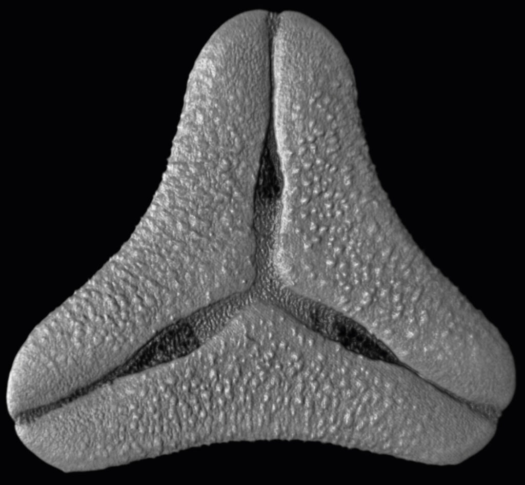
Black and white microscopic image of a pollen grain
Confocal micrograph of a pollen grain from Psittacanthus oblongifolius, a type of mistletoe from Peru. The image is part of imaging and identification project of tropical fossil pollen at the Smithsonian Tropical Research Institute in Panama.

Unlocking these clues often requires local insights and experience-based imaginations—like those that come from growing up smelling the Salto del Tequendama and hearing its legends—to open new interpretations of how mountain climates have changed since they were covered with different types of vegetation than today. New interpretations help validate the accuracy of climate models and can inspire new insights.

Research being conducted in Colombia on fossilized lipids offers an example. Nearly a hundred years after the earliest climatic studies of tree rings, scientists first reported on this proxy. These lipids, which once coated the cell membranes of certain types of bacteria, are readily found in soil and rocks, lake bottoms, and the sediment left by rivers—anywhere bacteria can live and die. As these bacteria grow, the chemical makeup of their membranes adjusts to best suit the temperature of their surroundings. While these bacteria exist all over the globe, their traits make them ideal for tracking historical temperature changes in the tropics. Whereas freezing temperatures send the bacteria into dormancy—during which they do not produce many lipids—bacteria in the tropics can offer uninterrupted temperature tracking. Moreover, in an ironic reversal, bacteria cycles of dormancy in middle and high latitudes tend to create a warmer and less accurate climate story than provided by other archives in those regions.

Bacteria lipids are particularly useful because they allow scientists to reach further into the past than some more established proxies, such as corals and stalagmite records. They provide measurements as far back as the Pliocene, approximately 5 to 2.58 million years, when greenhouse gases were as high as they are today—around 400 parts per million of carbon dioxide in the atmosphere—or even higher.

Until now, much of the temperature proxy data from this epoch have come from marine sediments or terrestrial archives from middle or high latitudes, but little has been known about how temperature changed in the tropics. Even though some climate models show how the tropics may have changed during this period, there is a scarcity of anchoring data from proxies in tropical archives that can validate such results. A few studies even suggested that tropical regions have experienced only minor temperature shifts or no climate change since the Pliocene. Bacterial lipids from the high plain of Bogotá tell a different story.

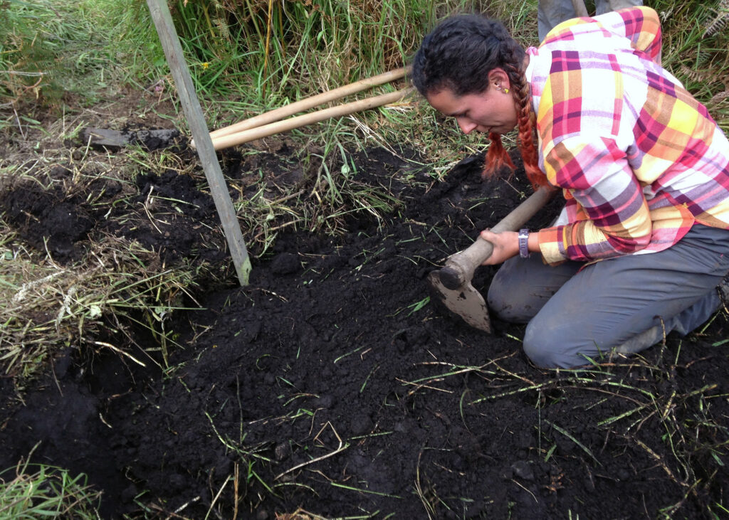
Color photo of woman digging into a patch of exposed soil
Geoscientist Lina Pérez-Angel collecting soil samples for biomarker analysis in Choachí, Cundinamarca, located in the eastern ranges of the Colombian Andes, August 2017.

Before the last major ice ages, marshes and meandering rivers dominated the now high-plain landscape of Bogotá. Temperatures inferred from bacteria lipids show that 3 to 4 million years ago the region was approximately 3°C warmer than pre-industrial levels. These findings offer an alarming warning for the region—heralding amplified warming of the Andes of Colombia and other high-elevation tropical areas (above 1,500–2,000 meters) that already experience hotter weather and drought during El Niño years. Even though past geologic periods cannot predict with 100% accuracy what will happen to specific communities in the coming years, these studies highlight regional and global effects that can inform and help prepare communities and governments when extreme weather threatens food and water security.

Collaboration is crucial for the refinement and development of proxies that finally serve tropical people and lands. First, since much of the laboratory technology needed to do this work comes from developed countries, we need partnerships between scientists in those places and scientists from tropical regions. Concurrently, local scientists must build partnerships with the communities who live in proximity to tropical archives. These networks can enable more sophisticated and elaborate experiments that give us more precise measurements and refined data for future climate projections.

We have seen the benefits of these collaborations with bacterial lipid studies in Colombia. Partnerships between local scientists and communities in the Andes allowed the strategic installation of temperature data loggers and sampling of modern soils in community lands. These modern measurements led to improved use of bacteria lipids to estimate historical temperature in the region by measuring in-situ temperature where the bacteria live rather than using air temperature data from satellites and extrapolation from weather stations. Later, temperature data from these lands was shared with community members along with meaningful conversations—in their language—about the reasoning and gravity of the changes in climate and weather we are collectively experiencing.

Millions of people witnessing the effects of our climate crisis do not survive through happenstance but through experience-based knowledge. Their know-how helps them endure disaster: floods, droughts, and other changes in weather patterns that disrupt biodiversity, food and water security, and agricultural production in the tropics. Valuing the lived experience is vital for interpreting local and everyday practices as mitigation strategies for our changing climate. Taken seriously, these strategies offer a hopeful reminder that communities are archives too, and perhaps the ones we need most.

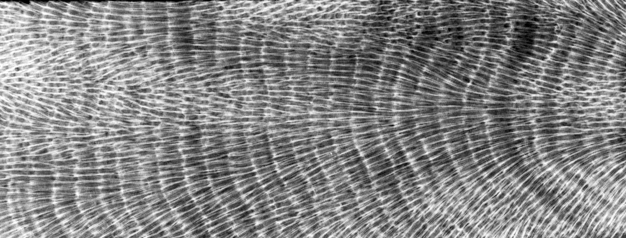
Black and white image of a cross-section of coral showing growth layers
Detail of an X-ray of a coral section taken from Dry Tortugas National Park, Florida, May 2012.

Form follows function. If one function of climate science is to address a global climate crisis, then the form of researching and making climate archives—how, where, and with whom—must also change. Climate science, like our climate crisis, is political and takes place geographically. Proxies that work toward justice are proxies from everywhere and for everyone.

Form follows function, further still. If one function of climate science is to address a global climate crisis, then communication is paramount. New climate archives and proxies without new ways to communicate across communities will lead to new inequalities in climate science. Likewise, new climate archives and proxies curated without attention to accessibility and justice can foster new hierarchies and betray any goals of addressing both inequality in paleoclimatology and supporting those who shoulder the burden of our climate crisis.

The current state of “scattered archives” hosted in far-flung regions and without standards for how to store physical samples, metadata, and derived proxy data is both politically and academically unsound and unjust. With this issue in mind, Nurhati and other paleoceanographers are constructing new models to save, standardize, and share marine archives through the grassroots organization MARPA (Marine Annually Resolved Proxy Archives). The scientists’ ultimate goal is to replace the individual curation that has historically dominated climate archiving with data sets and repositories that reflect community needs.

In Colombia and other tropical regions, MARPA can serve as a model for how to organize and expand terrestrial archive collections most equitably. Expanding this model to include the local and everyday interpretations of climate change will leave us with an abundance of proxies for justice. It’s not a matter of looking and uncovering but of respecting and valuing.

FOR EDUCATORS
The authors have developed lessons plans on natural archives and climate literacy for 4th- and 5th-grade classrooms that follow Next Generation Scientific Standards.

More from our magazine

Oil painting of old man holding a flask with liquid inside
DISTILLATIONS MAGAZINE

As Good as Gold

Why do we still study the color of urine?

A woman examines a TV dinner box she has taken from the freeze
DISTILLATIONS MAGAZINE

From the Front Line to the Freezer Aisle

How World War II changed the way we eat.

Old photo of women on a factory floor surrounded by munitions shells
DISTILLATIONS MAGAZINE

Picric Acid’s Volatile History

A mutable chemical and our collective choices.

    Republish

    Copy the above HTML to republish this content. We have formatted the material to follow our guidelines, which include our credit requirements. Please review our full list of guidelines for more information. By republishing this content, you agree to our republication requirements.