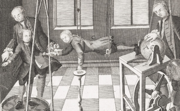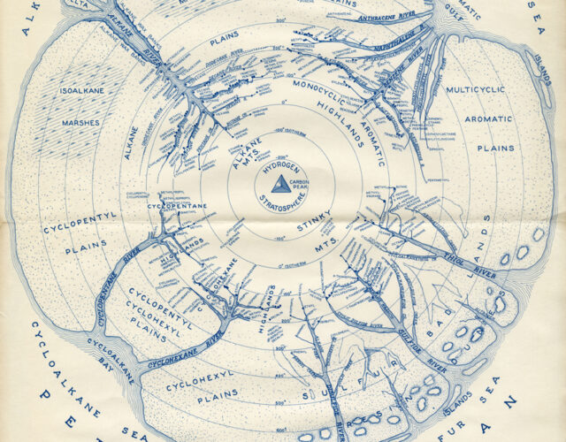
It looks like a mappa mundi, a modern draft of those medieval creations that mashed the known world flat like a tostone, making a plate of distorted continents ringed with ocean and veined with rivers and seas. The purpose of those old maps was never navigational; they were made to teach the viewer about the larger world and what it held. The most sophisticated were annotated with descriptions, histories, and mythologies of the people and places Europeans had to that point encountered.
Whether intentional or accidental, the map shown here shares many of those medieval conventions, and its creator’s pedagogical goals echo those of the old mapmakers. But while early cartographers depicted what they thought was geographically important, research scientist Harold Smith is showing us what is geologically important, at least to him and his colleagues. Recently uncovered in CHF’s archives, “The Petroleum World” registers what scientists at the end of World War II knew of the complex mix that makes up crude oil. Smith is doing what today we’d call data visualization.
Smith gathered his data at the U.S. Bureau of Mines’ Petroleum Experimental Station in Bartlesville, Oklahoma, where he spent his career researching the chemical composition of petroleum. Despite a playful disclaimer—“any resemblance to any other map is unbelievable”—the drawing was more than a lark for its maker. Smith made that point clear in 1948 when he first published “The Petroleum World” in a C&E News article of the same name. “Although it has a frosting of humor, the basic ingredients are for serious consumption,” he writes. Smith arranges petrochemicals by composition and boiling point. The latter is marked by concentric rings that radiate from a central mountain of elemental carbon, which rises into a stratosphere of hydrogen (those being the basic ingredients of all hydrocarbons). Different symbols distinguish chemicals that scientists have identified and others that are only presumed; darker shaded regions indicate where data are sketchier.
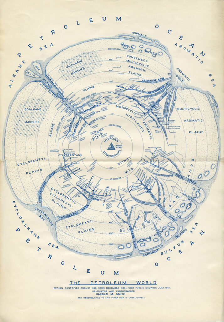
In 1966 Smith published a revised version of the map, one that demonstrates the accumulation of knowledge in the intervening decades. Acting on an idea presented in the 1948 article, Smith splits his map into two hemispheres, one to capture the components of petroleum made up of hydrogen and carbon alone, and the other to relay all that had been learned of the sulfur-, oxygen-, and nitrogen-containing compounds found in crude. In these newer drawings Smith speculates on the primeval sources of petroleum, imagined as highlands named Eucalyptus Mountain, Cholesterol Peaks, and the like. From these hills trickle aromatic and aliphatic creeks that flow to large rivers of familiar and not-so-familiar families of petrochemicals.
The large format of CHF’s print (about 11¾ inches by 17 inches) and its presence in the papers of Paul D. Bartlett, a Harvard University organic chemist, hints that the map may have given Smith a bit of notoriety within his circle. It’s easy to imagine the map as a calling card distributed to colleagues at conferences and social gatherings. The peculiar and initially disorienting choice of visual metaphor draws even the casual viewer’s interest. Smith creates an imaginary subterranean world of tarry rivers, gassy marshes, and waxy islands, precisely drawn and Tolkien-esque in conception but ultimately utilitarian. “In these days when the papers and radio tell of the passing of geographic frontiers it is interesting to find that scientific frontiers are many and widespread,” Smith wrote in 1948. “It is hoped that the unknown areas of this map will encourage more research on that part of the petroleum beyond the present borders.”